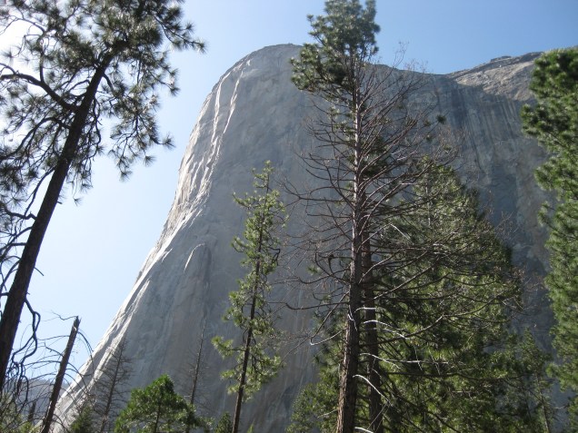
 Of all the beautiful places we have traveled, Yosemite continues to be my favorite. It’s majesty and beauty will leave you awestruck, there aren’t enough adjectives to describe it. If you’ve never thought of putting it on your bucket list, get out a pen and add it to the top right now. Just go! We’ve had the pleasure of visiting a few times over the years, The first was a day trip on the Harley, with a short hike to Bridalveil Falls. It was summer, so all I can say is thank goodness we were on the bike, cause can you say Crowds! I can do a whole blog post just on traveling to national parks in the summer, but we’ll save that for later.
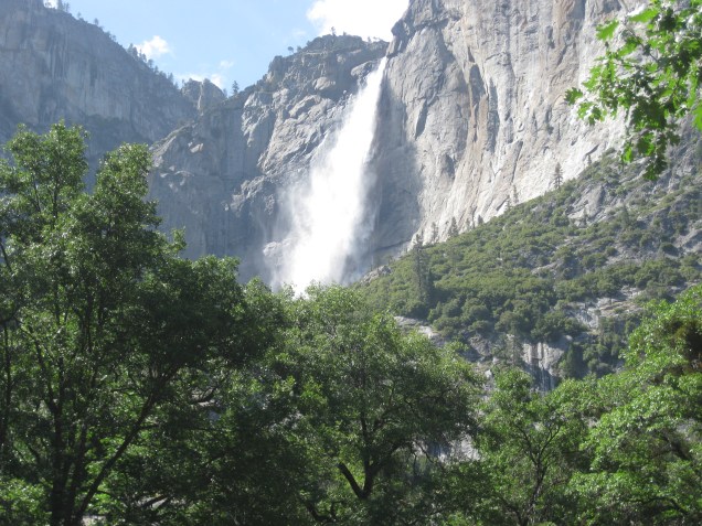 The second trip we went with the boys and hiked Upper Yosemite Falls. This is where I got bit by the hiking bug, and addicted to the high you get from it! But please, allow me to educate you for a moment. To someone who was born in the Deep South, and has no clue what “elevation” is about, this in hind site was probably not the best idea for a maiden hike higher than a curb. When you read the hike details on the hiking map legend, it goes something like this…A 3.5 mile, 2700 ft. elevation gain, 6,526ft elevation, moderate, approx 3-5 hours round trip (this estimation includes the lower hike to Columbia Rock) Now, in my mind, I’m thinking “I walk way more than that up and down ” The Avenue” for a parade during Mardi Gras season” piece of cake right? Could. Not. Have. Been. More. Wrong!
What the hiking map legend should have said was…”Hey cowboy, this is 135 switchbacks on a steep ass incline, it’s rocky and uneven and is going to make your lungs feel like they are going to explode, your legs will feel like shaky little toothpicks, there are no bathrooms along the way, you will cry (which I did 3 times) It’s 7.2 miles ROUND TRIP, it will take your couch potato butt 10 hours, so bring a headlamp (which I didn’t), you will want to quit at least 10 times, (which I did) and oh, ohhhhh let’s talk about the blisters you will get on the tips of all 10 of your toes on the hike back down! Not to mention every good intentioned hiker on their way down that passes you is going to tell you “not much farther” and “almost there” for encouragement because they see the twisted anguish on your face!” These are LIES, all lies! Yep, that’s what it should of said.
We went for it. 8am, myself, my husband and our two young, physically fit 19 and 24 year old sons, one a Marine. And yes, everything that I stated above the map legend should have said, I did. (Plus one other thing I won’t mention) For this I thank God for my husband. For every meltdown he would simply take me by my shoulders, turn me around to look over the valley, and say “but look how far you’ve come.” That would be all I needed to hear for the voice in my head to kick in and say “if you quit this, you’ll quit everything” and I would start moving with new fueled determination. (For about 5 switchbacks, then this process would repeat itself) We did finally reach the top. It was absolutely breathtaking and worth every tear, ache, pain, bruise and blister. We finished at 6pm. 10 hours later! And guess what? Without a doubt I would do it again in a heartbeat. What I wasn’t prepared for was the week long high that I got from it afterward. I totally get why people live to do this. Half Dome, you’re next!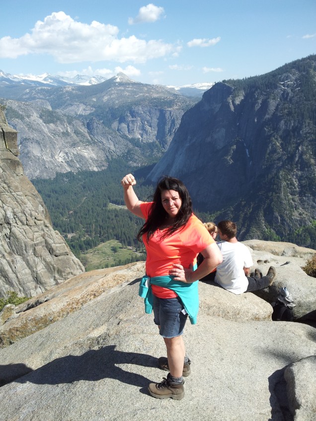
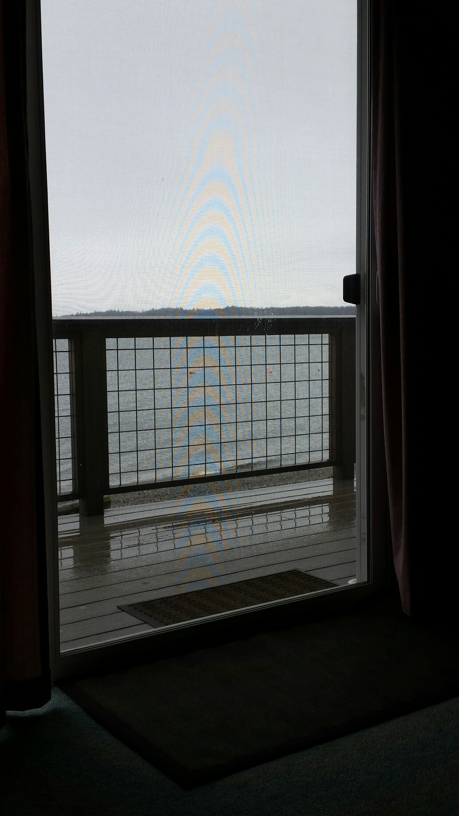
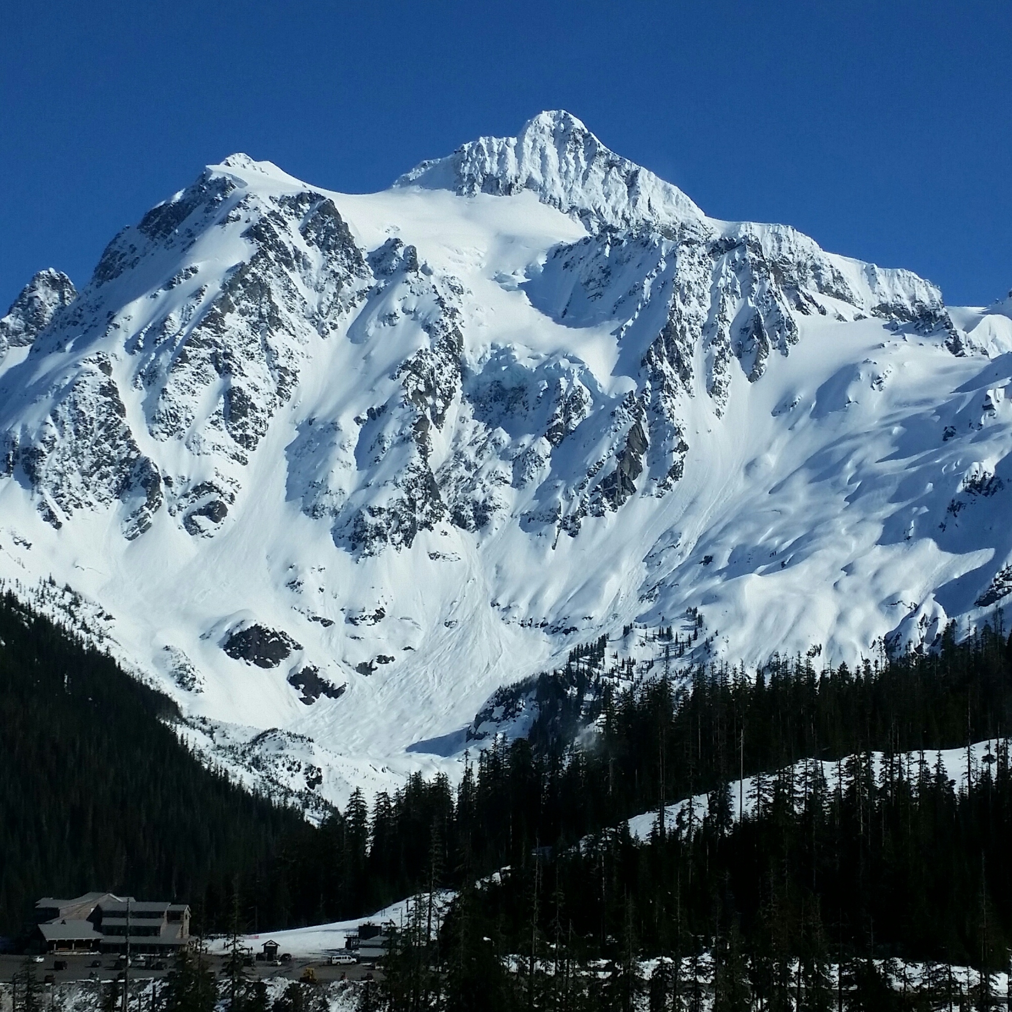
We went back this year on our road trip out to California during the Winter. We got lucky one day, and the main road had reopened after a snowstorm and some mudslides. On a side note, if you are ever traveling in elevations during Winter or Fall, always, always, check the road conditions on the local transportation website, or if you are heading to a national park, check the park website. This is the difference in a wasted day of travel, and detouring to see something else. Yosemite is usually hard to access in the winter because the main roads close without a moments notice, simply because the weather can change without a moments notice. (Mother Nature is fickle that way) and tire chains are required. They will fine you and turn you around if you don’t have them. Resulting in more wasted travel time. If you live in an area where you would get struck by lighting before ever using tire chains, you can rent them. I’m so glad we were able to make it in to the park on this trip. It was one of those unplanned, unexpected surprises I talk about! Yosemite in Winter is beyond beautiful.
Getting there is pretty straight forward. You can fly into San Francisco, Oakland, or Sacramento. It’s about 200 or so miles, and 3.5 hours depending on which area you’re coming from. Once you reach the main entrance, it’s another 26 miles to the valley floor. There is no limit of photo ops along the way. You’ll want to make lodging accommodations inside the park, there are a number of choices from 5 star (Majestic Yosemite hotel) to tent camping. We stayed in Curry Village, which are really affordable tent cabins, it’s not as awful as sleeping on the ground, but they do have bear lockers outside each one so you can lock up your food and toiletries. Yep toiletries, evidently bears will try anything once! The shower situation is communal, but I think slightly roughing it is part of the experience. Whichever way you decide, it books up fast, so plan accordingly. There are hotels and lodging in the Yosemite area, Groveland is about 30 minutes away and another 30 once you’re in the park. I would recommend at least 2-3 full days in the park. Research which works best for you.
The best time to visit is in the Spring, crowds aren’t at an optimum yet. Summertime in the park is super crowded, if this is the only opportunity you have to visit, allow extra time for traffic and crowds, and definitely utilize the park buses. The weather in Spring is great for hiking, (always layer) it will be chilly at night. You will still have to check road conditions, some roads don’t open till May for the season, and there can be Spring storms. I can’t stress enough to always check road conditions. I hope this was helpful, I hope you take your family and go! It will be one of the best vacations ever! ⭐️⭐️⭐️⭐️⭐️
Love, adventure and safe travels.
M